Project description

The aeolian desert in Iceland, molded by volcanoes and glaciers, features vast black expanses dotted with patches of green moss. Reminiscent of the lunar landscape, it evokes a feeling of "magnificent desolation". Since Iceland's early settlement, particularly after the Katla volcano eruption, the Mýrdalssandur Desert has been shaped by glacial floods, leading to increasing dune density and slow vegetation succession. Each dune acts as an independent ecosystem, stabilizing dust, capturing seeds, and enhancing ecosystem diversity.

Due to overgrazing, logging, and human settlement practices, Iceland's ecosystem faced severe threats, leading to rapid land degradation and the disappearance of forested areas. In response, the country introduced an alien species, the Alaskan lupine, in recent decades to aid in desert soil improvement. However, the lupine's rapid and unchecked growth in the desert environment has surpassed expectations. While it has played a significant role in enhancing soil quality, its unrestricted spread has resulted in it dominating large portions of the desert. Additionally, the effects of global warming have further fueled the lupine's rapid expansion into Iceland's inland highlands.

This project aims to redirect focus to the iconic black desert, a symbol of Iceland's unique landscape that has long captivated renowned filmmakers and photographers for its stunning scenery. As an outsider, the unchecked proliferation of lupines not only poses a threat to the indigenous ecosystem but also diminishes the once-endless expanse of the desert landscape. In response, the goal is to preserve the geological integrity of the desert while mitigating the dominance of lupines. Therefore, the project strategy will focus on controlling lupine growth and promoting the development of the nebkhas sand dune ecosystem, striving to achieve a harmonious balance between the two elements.
The Proposal of Mýrdalssandur Desert

This plan illustrates the comprehensive intervention and planning of the entire desert region. A tour route spans from the coastal landscape in the south, traversing Mount Hjörleifshöfði and the Lupine fields, through the Sand Dunes Park and Mount Hafursey, leading to the renowned Katla Ice Cave within the Kötlujökull Glacier in the north. The route comprises a total of six sites, with particular emphasis on the boundary between the dune park and the lupine field. These pivotal points, where the lupine and the black desert converge, elucidate the project's expressed stance.

The proposal of Mýrdalssandur desert expand
A sectional perspective of the dune geopark
The Dune Geopark

A sectional perspective showcases the overall effect of the dune geopark, emphasizing the planning of pathways and the design of bridges. It illustrates how people navigate through the complex terrain and rivers within the dune park, addressing initial concerns about inconvenience and safety in the desert environment. Simultaneously, it demonstrates how visitors will access and engage with the dune landscape, fostering interaction with the surroundings.

Control and management of the lupine

The initial step in lupine control involves the regular removal of a portion of the lupine during the spring planting season to create exposed patches. 

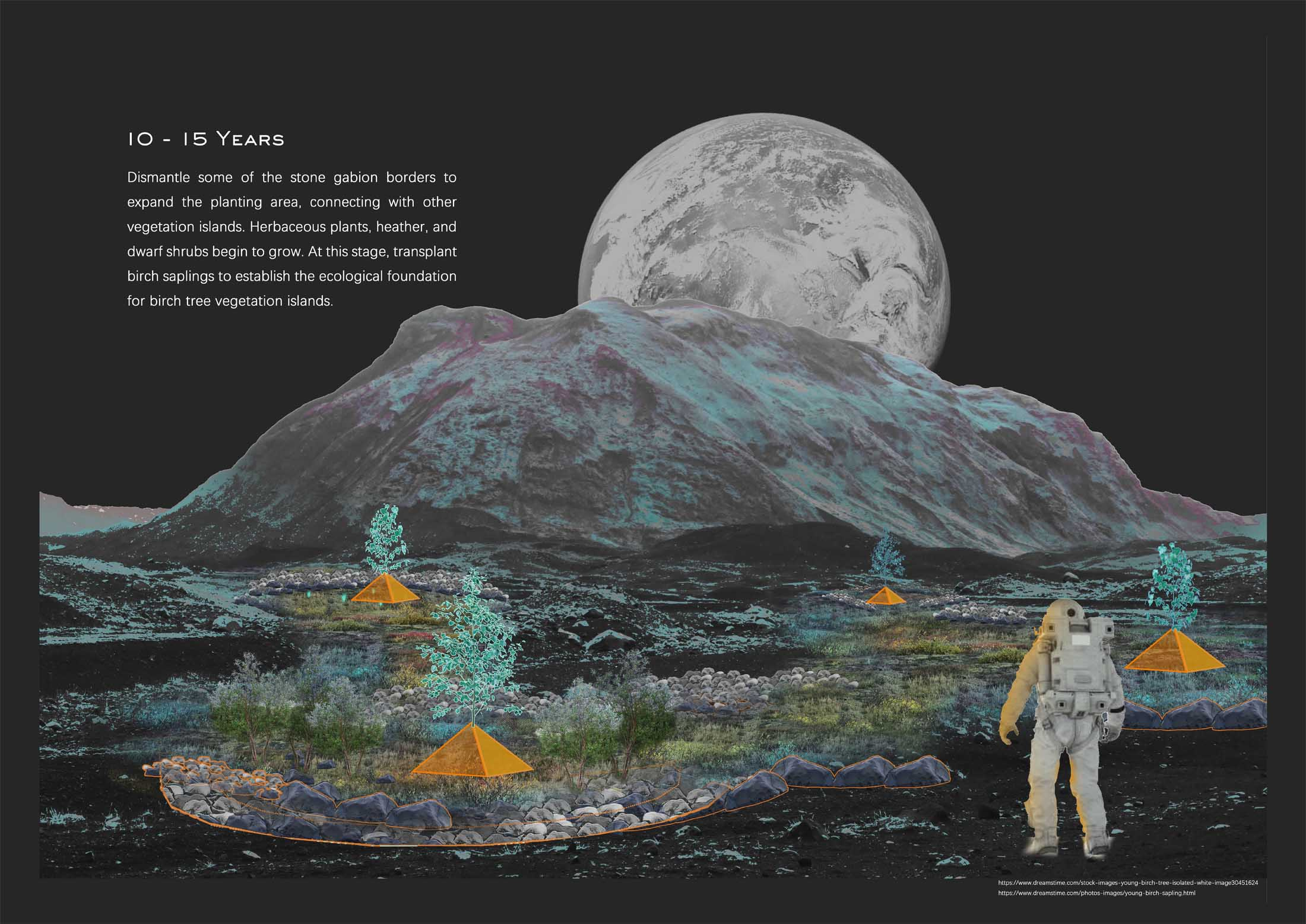
Following the removal of lupine patches, these cleared areas, known as spacer bands, are designated for replanting subarctic plant communities. 

As native species reclaim dominance, shrubs and birch trees begin to thrive, causing lupine to gradually recede and maintain a balanced density due to reduced sunlight penetration. Simultaneously, on the opposite side of the boundary, dune proliferation commences.

The plant spacing zones serve as seed sources for the dune ecosystem, facilitating the rapid growth of vegetation on the dunes and accelerating the formation of the dune ecosystem.

The interaction of dunes and lupine borders
The interaction between the lupine boundary and the desert

On the opposite side of the desert-lupine border, the dunes gradually appreciate over time. With the planting intervals serving as abundant seed sources, wind dispersal carries them onto the dunes, initiating natural succession. This process will expedite the development of dune ecosystems over the next 50 years.

A perspective drawing showcases the envisioned future landscape of the aeolian desert territory and illustrates how people can engage in landscape narratives from an social-ecological perspective. expand
An Socio-ecological Vision of the Aeolian Dune Geopark
A social-ecological perspective of the dune geopark

This social-ecological vision paints a picture of the envisioned future development of the site: 50 years from now, the density of the dunes has increased reasonably, while the lupine has been brought under control. People traverse the dune park, where dense green moss blankets the black desert. The tourism in the dune park and maintenance of the lupine provide job opportunities and economic benefits for local residents. Meanwhile, Hafursey Mountain, serving as a bridge connecting the glacier and dune landscapes and offering the best vantage point of the site, garners renewed attention. It becomes a popular destination for hikers and birdwatching enthusiasts and photographers.

Student list
open list
close list